Lakes are not permanent. Over time all lakes will shrink and disappear.
Lakes are not permanent features on Earth. Over long periods of time, most lakes slowly change and eventually disappear. This happens in a few ways. Some lakes dry up when their water sources decrease, especially during long-term climate changes. Others gradually fill in with sediment—tiny particles of soil, sand, and decaying plants that wash in from rivers and streams.
Over thousands or even millions of years, in a process called habitat succession, a lake can become a wetland, then a meadow, and eventually dry land. However, this process is very slow, and some lakes can last for a very long time. For example, very deep or geologically active lakes can remain for millions of years under the right conditions.
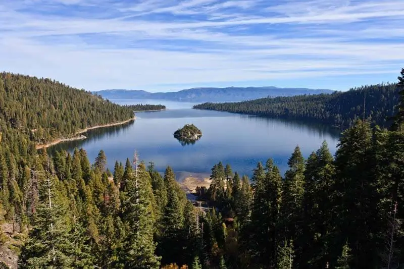
Lake Tahoe is a basin lake.
The Earth’s surface is always slowly moving and changing due to plate tectonics. Over long periods of time, this movement can create low areas in the land called basins. When these basins fill with water, they become lakes. Many lakes in the western United States formed this way because the region has many active faults and is slowly being stretched apart.
One well-known example of a basin lake is Lake Tahoe on the California–Nevada border. It sits in a deep structural basin formed mainly by movement along large cracks in Earth’s crust called normal faults. Lake Tahoe is especially deep—about 1,600 feet (500 m) in places—because the crust continues to move even today. Small earthquakes in the region show that the faults are still active.
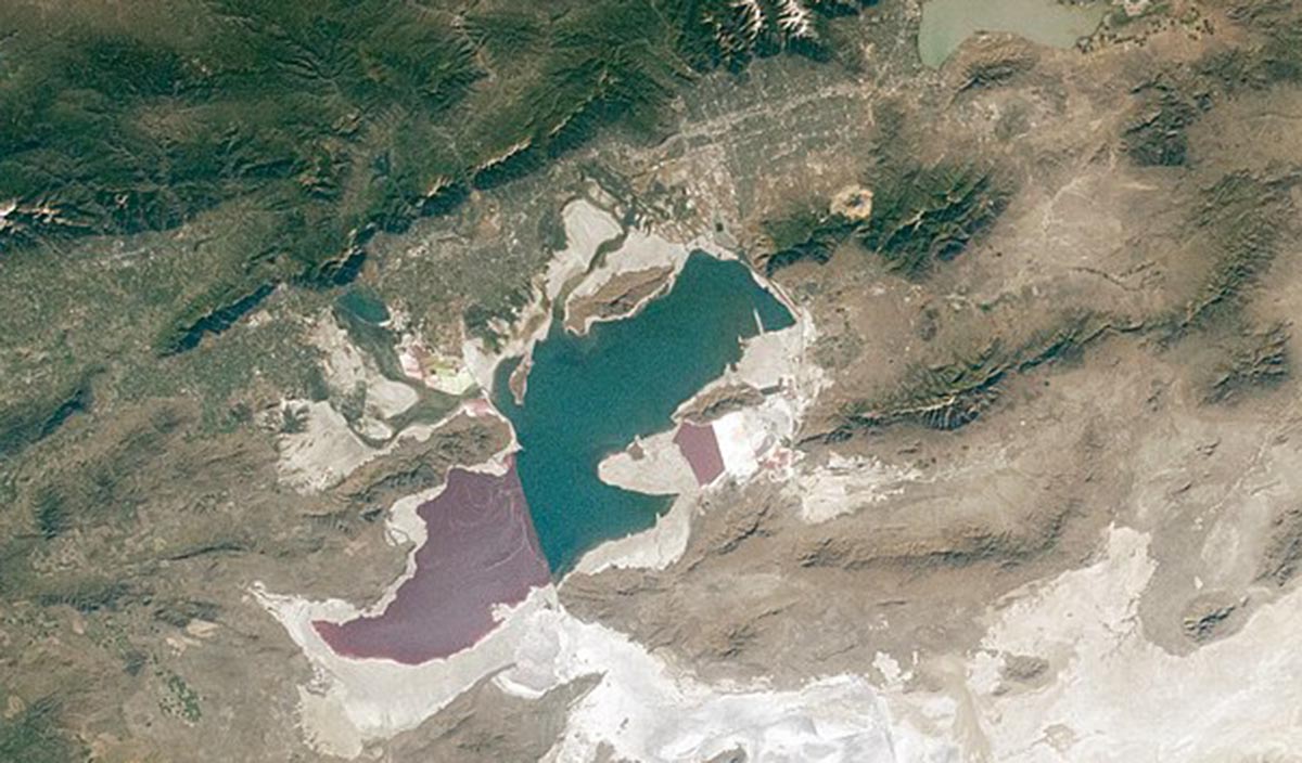
Great Salt Lake
Over long periods of time, Earth’s surface slowly changes. The movement of tectonic plates can gradually push land upward to form mountains or basins, while climate changes can raise or lower sea levels. These slow processes can trap water in low areas or cut it off from the ocean, creating inland seas or lakes with no direct connection to the ocean. The Caspian Sea, the largest inland body of water on Earth, is actually a very large salty lake.
In the United States, the Great Salt Lake in Utah formed from the much larger Ice Age lake called Lake Bonneville. As the climate became warmer and drier after the Ice Age, most of Lake Bonneville evaporated, leaving behind smaller lakes and salt flats, including the Great Salt Lake.
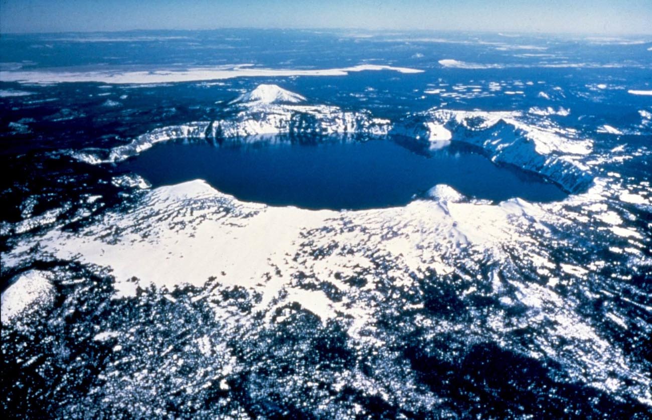
Some lakes form in the craters, or calderas, of extinct volcanoes. (Crater Lake in Oregon)
Some lakes form in the craters, or calderas, of extinct volcanoes. Crater Lake in Oregon lies in the caldera of an ancient volcano known as Mount Mazama.
It is the deepest lake in the United States and the seventh deepest lake in the world. Other lakes have formed in craters left by meteorites.
Impact crater lakes are lakes that form when a meteorite hits Earth and leaves a large, round depression that later fills with water. They are fairly rare in the United States, but they can be found in other parts of the world.
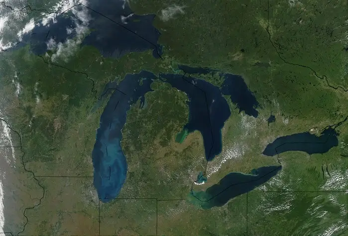
Glaciers are responsible for lots of the world's lakes. (Great Lakes)
Glaciers have helped shape many of the world’s lakes. During the Pleistocene Epoch, which lasted from about 2.6 million to 11,700 years ago, Earth experienced several major ice age cycles. During these colder periods, large sheets of ice called continental glaciers grew and slowly moved across parts of North America, Europe, and Asia.
As glaciers advanced and retreated, they acted like giant bulldozers. They scraped, carved, and deepened the land beneath them. In some places, this erosion created large basins (low areas in the ground). When the climate warmed and the glaciers melted, those basins filled with meltwater and became lakes.
The most recent glacial period is often called the Wisconsinan Glaciation (about 115,000 to 11,700 years ago). During this time, glaciers covered much of northern North America. Many well-known lakes in northern regions formed during or after this period, including the Great Lakes and the Finger Lakes. These lakes were shaped not only by melting ice but also by the weight and movement of glaciers, which deepened valleys and left behind natural dams called moraines.
In New Hampshire, Lake Winnipesaukee also formed near the end of the last ice age. As the Laurentide Ice Sheet melted and retreated, it left behind uneven land and meltwater that collected in low areas, forming lakes like Winnipesaukee and other lakes found in the state.
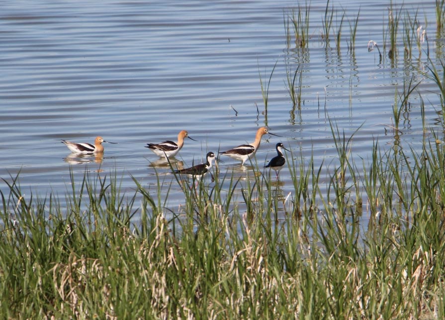
Avocets and black-necked stilts wading in a lake.
In some temperate regions, lakes go through dramatic changes in temperature as the seasons change.
SUMMER
In the summer, the water temperature in lakes is not the same from top to bottom. There are three different layers. The top layer of water is heated by the sun and stays warm. The middle layer is cooler than the top layer, and the bottom layer is the coldest. Because of the warmer waters and more plentiful food supply, almost all lake creatures spend the summer months in the upper layer.
FALL
During the fall, there is less sunlight to heat the lake water during the day. Lakes can lose more heat at night, and wind can mix up the water layers. When all of this happens, the water in lakes can become close to the same temperature at all levels. This is called fall overturn.
WINTER
During cold winter months, lake temperatures can reverse. The top layer becomes the coldest layer! When a lake’s surface water reaches 32 degrees Fahrenheit (0°c), it begins to freeze. When the surface of the lake freezes, the water underneath is protected from wind and heat loss. In the winter, the deeper you go in a lake, the warmer the water will be!
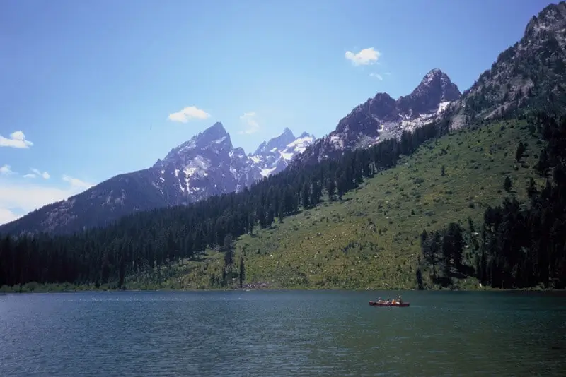
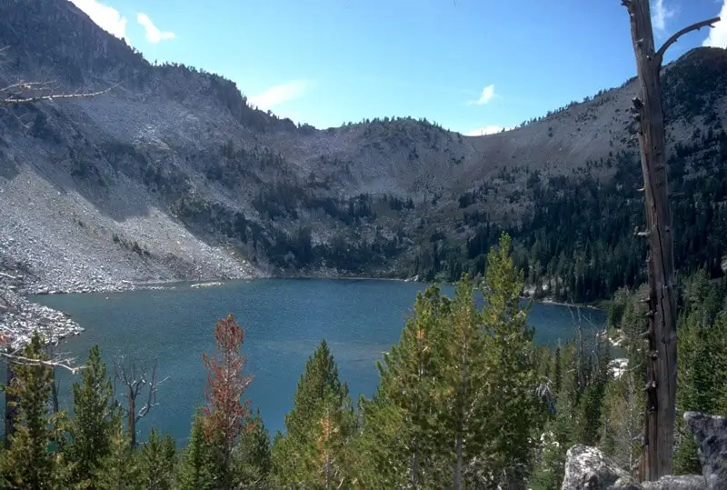
Lakes can be divided into three zones based on how much light penetrates the water. (Jenny Lake, Wyoming)
Lakes can be divided into three zones based on how much sunlight reaches the water, which affects where plants and animals can live.
The littoral zone is the shallow, nearshore area of the lake. Sunlight reaches all the way to the bottom here, allowing many plants to grow. This zone often has the greatest variety of life, including plants, insects, fish, and amphibians.
The photic zone is the sunlit open water farther from shore. Light supports algae and tiny plants, but it does not reach the bottom.
The aphotic zone is the deep, dark water where no sunlight reaches, so plants cannot grow. Animals here rely on food from the upper layers.
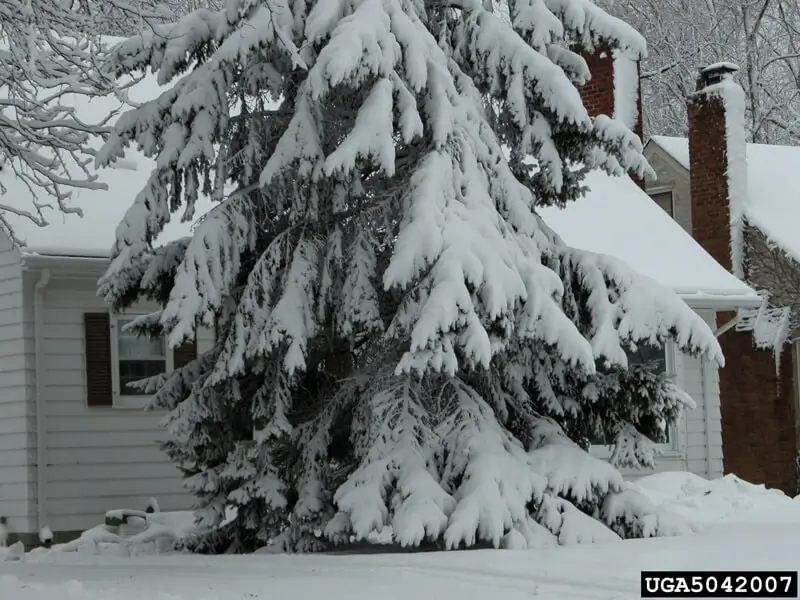
Lake effect snow happens when a cold air mass passes for long distances over warmer lake water.
Some lakes are so large that they can influence the weather around them. One example is called lake-effect snow. This happens when a mass of cold air moves over a lake that is still relatively warm.
As the cold air passes over the warmer water, it picks up heat and moisture. This makes the air warmer and wetter. When the air reaches land again—especially along the shoreline—it cools down quickly. The moisture in the air then falls as snow.
This process can create heavy snowfall in certain areas, even when places just a few miles away get much less snow. The Great Lakes in North America are especially well known for producing lake-effect snow, which often impacts nearby states during the winter.
There are about 30,000 cubic miles (48,270 cubic kilometers) of lake water in the world. (Maxwell Lake, Oregon)
Squam Lake